Monday, February 24, 2014

Historical Settlement of North America

(Link to www.tahg.org)
The first European settlements in the United States were in the east coast. They created the 13 colonies and started to gain their independence from being British colonies to their own independent country. California was not part of this because the Europeans have not traveled west yet. This was mostly because of the terrain of the United States. The Appalachian mountains blocked westward movement until the 1850's. Before the westward migration, California was populated by Native Americans and
was part of Mexico. There was a clash between the settlers in California and Mexico to gain control over the territory. After the signing of the Treaty of Guadalupe Hidalgo it ended the battle and split the region of California to the US and Mexico. Although the east created state boundaries by the metes and bounds system, the west created their boundaries with rectangular survey system. That is why the east forms its state boundaries by the topography while the western states have straight lines for borders and look more rectangular.

Friday, February 21, 2014

North America's Environmental Setting


(Link by David Lynch)
Los Angeles sits on the Pacific plate which collides with the North American Plate. These two tectonic plates create the San Andreas Fault which causes most of the earthquakes in Los Angeles. The fault is a transform plate boundary where the two tectonic plates slide past each other. Also the Salton Sea was accidentally created by irrigation from the Colorado River. The Salton Sink, a dry lake basin, needed water for farming but with heavy rain the Colorado River flooded and all the water was irrigated to the Salton Sink creating the largest lake in California (source). Because Los Angeles is on the west coast, there is a maritime influence on the city. This creates lower highs and higher lows. There is less change in the temperature range throughout the year compared the the continental climate. The body of water cools the air creating the maritime climate. Any place that is near a large body of water has a less temperature change.


Thursday, February 13, 2014

Introduction


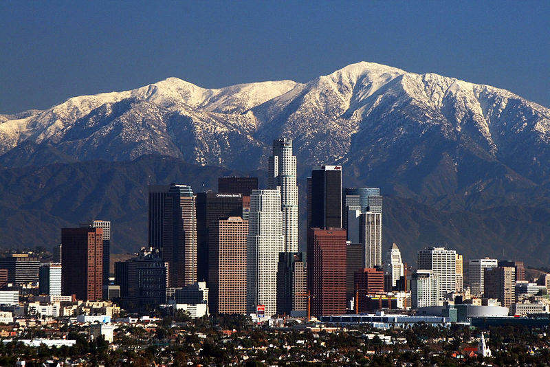
File:LA Skyline Mountains2.jpg
Link by Nserrano
California is 163,696 sq mi out of 3.6 million sq mi of United States, being the third largest state in United States. Also California is the most populated state in the United States. The population density of California is 246/sq mi, while the average in America is 77/sq mi (source). California also contains Los Angeles the second most populated city and has a very diverse population. There was a surge of immigration from Asia and Latin America during the 1960's. According to Garreau's definition of formal region, Los Angeles covers a lot of southern California